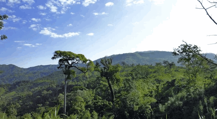
Mount Saka Haphong is one of the highest mountain peaks in Bangladesh, not Keokradong or Tajingdong. Also known as Saka Huffong, Madak Tung, or Modak Tuang. Madal Tung wrote it on an ancient map. Some say it will be alcohol. The locals call it Border Hum. Bombers call it Klangmoy, many guides also call it by this name. According to GPS readings taken by various explorers including US Topography Map, Russian Topography Map, Google Map, Google Earth, Travel Bangladesh, Adventure BD, Sakhafong is now one of the highest mountain peaks in Bangladesh. According to Mapjok’s calculations, 1050 meters or 3445 feet (surveyed on 12 December 2014).
Saka Haphong At Bandarban
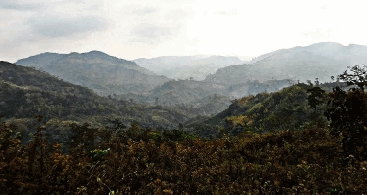
How To Go There Saka Haphong Mountain
You can take a bus directly from Dhaka / Chittagong to Bandarban. After reaching Bandarban, there are three directions from Sakahafong – Thanchi, Ruma Bazaar, and Remakri Bazaar.
Route from Ruma:
Boga Lake – Keokradong – Thaikang Para – (with new bombs laid) Dulacharan Para – Hanjrai Para – Nifiu Para – Summit. The first teams, however, would go up from Dulacharan Para to Shalukia Para, after which the summit would be Nefiu. Now Shalukia doesn’t go very far.
Boga Lake – Keo – Take the right turn from the cemetery without entering Thaikang Para, Remakri Canal through the bottom of Tamla Para – New Bom Para – Dulacharan Para along the canal – Then Nefiu Para – Summit.
During the rainy season, it is difficult to catch the canal, so many times Thaikang Para – Tamla Para – become Hanjrai Para – Nefiu – Summit (However, the path with Taml or New Taml is a lot of detours, more ups and downs)
Boga Lake – Keo – Baklai – Simpampi – (Tajingdong Summit increases) then down the Remakri Canal to Hanjrai – Nephew – Summit (detour, water problem, but Tajing Dong bonus
Route from Thanchi:
Thanchi – Boarding Para – Sherkar Para – Tajingdong – Simpampi Para – Hanjrai Para – Nefiu Para – Summit. From Sherkar Para, you can also go through Do Tong Para and Sajai Para without going to Tajing Dong, but there is no Dotang Para trail from Sherkar. (Getting up and down, waterless shade)
Thanchi – Boarding neighborhood – Kaitang Para on the way to Jiri – Jiri Dhare Agano – Simpampi Para Up – Hanjrai Para – Nefiu Para – Summit.
Route From Remakri:
Nafakhum – Dula Para – Sajai Para – Nefiu Para Summit. Nafakhum – Jinnah Para – Amiyakhum – Satbhai Khum to Hanjrai Para – Summit Nafakhum – Jinnah Para – Amiyakhum – Haye Sajai Para – Excluding Jinnah Para on Summit Route 2 and 3, Thuisa Para can also be passed through Atiram Para. At present, it is more popular with this side.
Where To Stay At Bandarban
Bandarban neighborhoods are available for overnight stays. If you want to camp, you can take the tent.
Read More:
- Mowdok Mual Hill
- Deem Pahar
- Kalapahar Hill
- Sippi Arsuang Hill
- Kirs Taung Hill
- Rajar Pahar
- All Bangla Newspaper
Frequently Asked Question:
- Saka haphong bangla
- Saka haphong map
- The highest mountain in Bangladesh
- Saka haphong trekking
- Tajingdong hill
- Jogi haphong
- Mountains in bangladesh
- Tajingdong height
We would like to set AGRO PARK AMD Echo Village and Resorts Hotel
Could advise area and land location .
Thanks